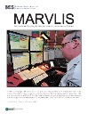
MARVLIS
PSAP Operations Monitor
NETCall
Fire/Rescue
Forecast LE
Brochures
Press Releases
Videos
Products
MARVLIS
TheAddresser
Esri Software & Trimble Hardware
Services
Consulting
Custom Development
Implementation
Mobile GIS/GPS
Contact Us / Support
About
In The News
Awards
Videos
Partners
Industry Links
Brochures
Press Releases
Menu
MARVLIS
PSAP Operations Monitor
NETCall
Fire/Rescue
Forecast LE
Brochures
Press Releases
Videos
Products
MARVLIS
TheAddresser
Esri Software & Trimble Hardware
Services
Consulting
Custom Development
Implementation
Mobile GIS/GPS
Contact Us / Support
About
In The News
Awards
Videos
Partners
Industry Links
Brochures
Press Releases
MARVLIS
MARVLIS PSAP Monitor
Getting There Is Half The Battle
MARVLIS Testimonial ROI
ArcNews Sunstar EMS
MARVLIS
PSAP Operations Monitor
NETCall
Fire/Rescue
Forecast LE
Brochures
Press Releases
Videos
Products
MARVLIS
TheAddresser
Esri Software & Trimble Hardware
Services
Consulting
Custom Development
Implementation
Mobile GIS/GPS
Contact Us / Support
About
In The News
Awards
Videos
Partners
Industry Links
Brochures
Press Releases